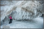
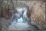
I just didn’t know what direction I wanted to go with this post. Originally it was going to be called The Evolution of Muskegon’s Ice Caves. But they’re so darn cool! I just want to share the cool pictures of them and drop the technical garbage!
So I’ll combine the two ideas and tone down the technical garbage and keep it cool.

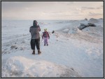
Here’s a picture of a surfer dude. It was taken January 4. He is approximately where the Ice Caverns are today. They started forming five days later. More on that in a second.
The pictures in this article are all captioned with the date it was taken and noting either Portal A or Portal B.

You see the circles around a couple sets of people. They are standing near the two entrances into this set of caves and caverns. If you want to see this exact location, go here to google maps (opens in separate window/tab) and it’ll help to be in satellite or earth mode.
So surfer dude is enjoying some heinous waves in a strong solid wind. Yes, it was windy. But in a funny way, it was the calm before the storm. Five days later, January 8, the East Coast was dealing with Winter Storm Juno. Here in West Michigan, we were dealing with the Winter Storm we called Thursday. Well, actually, we called the day of the week Thursday.
The forecast was for “near-blizzard” conditions. Here at the lake we exceeded those condition and approached hurricane conditions. 45 mph winds and 65 mph wind gusts. An inch of snow an hour.
A few days later I found the beach.

Yes, I know, the above picture I featured in a blog post from a couple months ago. But ya gotta admit, it’s sick! It’s cool! And I did say I was gonna keep this cool!
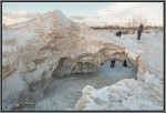
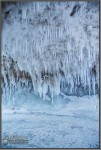
Looking at the following two pictures, also taken the same day as that cool picture of the above lighthouse, you can see the beginnings of what are the ice caves. In fact, I would dare say the caves and caverns are already there. That is, they are hollow but closed.
Before the winter storm we called Thursday, we did have a couple days worth of gale force winds Tuesday and Wednesday. These ice cliffs had already started forming, but not nearly as impressive as they are in these shots.
Scroll back up and compare the following two shots with the panoramic picture. You should get a sense of the scene. You’ll also note that the water surface is frozen and chunky.


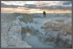
So you’re catching this, right? Above, the surface of the lake is frozen and chunky. On January 11, with a high temperature of 34 F. And then the next day, January 12, for the sunset, I’m standing (actually I was laying on my belly) at the same location, just facing a slightly different direction. High temperature this day is 33 F. (Can you find the swimming duck?)

A few days later is hit 40 F. Warm. Wind. Energy creating an undulating sea. The surface of the lake is not frozen, a little chunky still, and it moves up & down. Grab the Dramamine.

Let’s fast forward about a month. Not a lot of change was occurring, nor was I predicting ice caves here. So I didn’t photograph this particular ice shelf.
It was February 12 I walked the breakwater a couple times. Once during the midday and once after sunset. This first half of February was a little warm, with daytime highs in the upper 20s F and even a couple upper 30s F.
We’ve already seen how the air temperature can effect the surface ice. A daytime high temperature of 33 F means most of the day was below freezing. Yet the ice had the capability to melt. Plus a little wind will break that surface ice. Now remember, Lake Michigan is an enormous body of water with a constant temperature ranging from the 40s to the 50s.

This above shot shows Portal A. That is the entrance to the caverns nearest the breakwater. On this particular day there was a lot of broken surface ice. It was also windy. Not crazy windy. Not gale windy. Maybe “small craft advisory” windy.
I’m standing on the breakwater while photographing the scene in the below picture. I recall feeling at my feet the WOOMPH energy when these waves crashed. It was quite sensational, but I have to note that the wind and waves and energy and resulting spray would be considerably less that that night of January 8 when we had near hurricane force winds.
Looking closely at the above photo, you can see through the ice cave. To stand at this exact spot today (March 6), you would see something radically different. From this spot, which I have identified as Portal A, is actually a small ice canyon. It’s about 5 to 6 feet deep and about 10′ to 15′ long. The Portal A entrance is a small hole only about 2 feet high.

Fast forward seven hours, shortly after sunset. Calm.

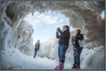
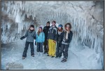
A few days later, Muskegon is still in the middle of a weather trend that is definitely winter. It snows every day and we’ve not witnessed an air temp above freezing. On this day, the high temperature was 10 F. These folks are looking into what is now Portal A. They are looking at surface water. Scroll up three photos and you will see approximately what these folks see.

A couple key components continue as the days progress. The winds have died down and the temperatures continue the way-below-freezing trend. The walls and domed ceilings of these ice caves remain in tack, though completely unseen from the breakwater. And the floors are becoming solid.

During the past couple of months, and especially during the night of Winter Storm Thursday, winds howled, waves crashed, water sprayed high into the air, and simply froze in place. droplet by droplet. It seems like a bit of a stretch of the imagination.
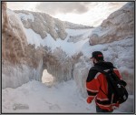
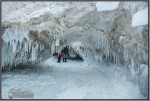
But hear me out on this one. In the below photo, I’m not really sure what these two are doing. They may have detected something I detected a few days prior to this shot and they were checking it out. While I was walking around that spot on the breakwater, the sound under my feet gave off a resonance that was notably hollow. Scary hollow. Thin ice hollow. Is there another ice cave under their feet?

Another observation made, in terms of the evolution of the Ice Caves and ice bergs lining the beach, is that they do move. Albeit, slowly. The particular Ice Cave is tucked in along the breakwater. It will shift very little compared to some of the other ice formations that I have witnessed during the past couple months.
I mention this as a reality check. A safety check. This ice is unstable. And keep in mind, it is floating. It’s all interconnected, and parts of these ice formations are gripping the breakwater and the beach — giving them SOME foundation. But still floating on a massive body of water. Water with temperatures well above freezing and constantly moving and flowing, even below the Ice Cave.
Here are the rest of the cool pictures plus a video tour like you’ve never before seen!
And the video tour of the Muskegon Ice Caves!
Please share the love with all those buttons under here!!


